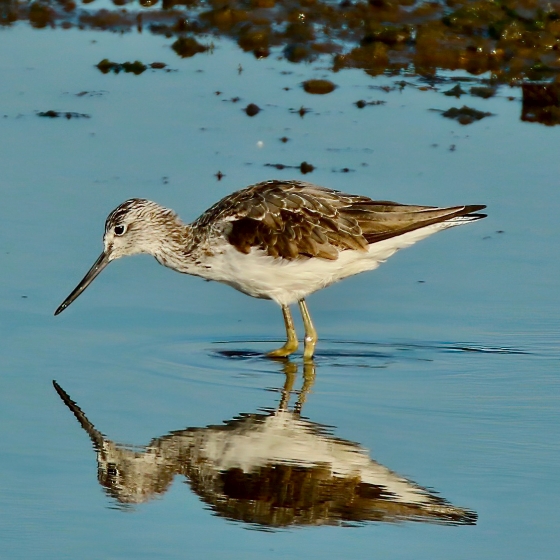
Greenshank
Introduction
This large, lanky wader is most often picked up in wetlands on autumn passage by its distinctive three-note call.
Reports to BirdTrack peak from mid-July to late-September, as individuals migrate south to their wintering grounds in the west of Africa. At this time of year, Greenshank can be found in both coastal and freshwater wetlands, but in the breeding season this is very much a bird of remote moorland, with breeding records confined to the Highlands and islands of Scotland.
Much is known about Greenshank breeding behaviour thanks to a classic study by Desmond Nethersole-Thompson, which was carried out in the Flow Country of northern Scotland. Territories usually include a large rock or dead tree as song-post.
Key Stats


Identification
ID Videos
This section features BTO training videos headlining this species, or featuring it as a potential confusion species.
Common shanks
Songs and Calls
Song:
Call:
Other:
Status and Trends
Conservation Status
Population Change
Greenshank breeds in the far north and west of Scotland where it is difficult to survey. The only national survey was made over 20 years ago and came up with a population estimate of 1,080 breeding pairs (Hancock et al. 1997). Hence the status and long-term trend is unclear. The breeding range in the 2008–11 Breeding Atlas was similar to that in 1968–72 with a very slight increase of 2% in the number of occupied squares (Balmer et al. 2013).
Distribution
Breeding Greenshanks are largely restricted to the bogs and moors of the northwest Highlands and Hebridean islands, with the highest densities in Sutherland, Wester Ross, Lewis, Harris and North Uist. Most wintering bird are associated with large estuary complexes throughout the coasts of Britain & Ireland. Densities are highest in the west, especially in Ireland and parts of western Scotland.
Occupied 10-km squares in UK
or view it on Bird Atlas Mapstore.
or view it on Bird Atlas Mapstore.
European Distribution Map
Distribution Change
There have been minor breeding-range expansions, mostly on Shetland, Lewis, North Uist and in West Inverness. Losses are most evident in the eastern fringes of the range, particularly in Badenoch and Strathspey.
Change in occupied 10-km squares in the UK
or view it on Bird Atlas Mapstore.
or view it on Bird Atlas Mapstore.
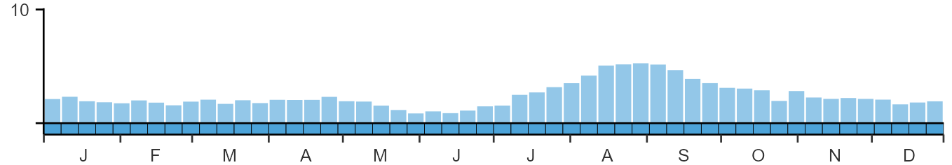
Seasonality
Greenshanks are recorded throughout the year, though most likely during autumn passage.
Weekly pattern of occurrence
The graph shows when the species is present in the UK, with taller bars indicating a higher likelihood of encountering the species in appropriate regions and habitats.
Movement
Britain & Ireland movement
Foreign locations of birds ringed or recovered in Britain & Ireland
Dots show the foreign destinations of birds ringed in Britain & Ireland, and the origins of birds ringed overseas that were subsequently recaptured, resighted or found dead in Britain & Ireland. Dot colours indicate the time of year that the species was present at the location.
- Winter (Nov-Feb)
- Spring (Mar-Apr)
- Summer (May-Jul)
- Autumn (Aug-Oct)

European movements
EuroBirdPortal uses birdwatcher's records, such as those logged in BirdTrack to map the flows of birds as they arrive and depart Europe. See maps for this species here.
The Eurasian-African Migration Atlas shows movements of individual birds ringed or recovered in Europe. See maps for this species here.
Biology
Productivity and Nesting
Nesting timing
Egg measurements
Clutch Size
Incubation
Survival and Longevity
Survival is shown as the proportion of birds surviving from one year to the next and is derived from bird ringing data. It can also be used to estimate how long birds typically live.
View number ringed each year in the Online Ringing Report.
lifespan
Biometrics
Wing length and body weights are from live birds (source).
Wing length
Body weight
Ring Size
Classification, names and codes
Classification and Codes
- Order: Charadriiformes
- Family: Scolopacidae
- Scientific name: Tringa nebularia
- Authority: Gunnerus, 1767
- BTO 2-letter code: GK
- BTO 5-letter code: GRESH
- Euring code number: 5480
Alternate species names
- Catalan: gamba verda
- Czech: vodouš šedý
- Danish: Hvidklire
- Dutch: Groenpootruiter
- Estonian: heletilder
- Finnish: valkoviklo
- French: Chevalier aboyeur
- Gaelic: Deoch-bhiugh
- German: Grünschenkel
- Hungarian: szürke cankó
- Icelandic: Lyngstelkur
- Irish: Laidhrín Glas
- Italian: Pantana
- Latvian: liela tilbite, tlitlis
- Lithuanian: žaliakojis tulikas
- Norwegian: Gluttsnipe
- Polish: kwokacz
- Portuguese: perna-verde
- Slovak: kalužiak sivý
- Slovenian: zelenonogi martinec
- Spanish: Archibebe claro
- Swedish: gluttsnäppa
- Welsh: Pibydd Coeswerdd
Research
Causes of Change and Solutions
Causes of change
The current trend is uncertain and hence drivers of change are also unclear. Some local declines may be linked to habitat degradation and afforestation (Hancock et al. 1997). However, Watson & Francis (2012) suggested a number of possible causes to explain local losses in Deeside including acidic deposition, overgrazing and trampling, disturbance, predation and reforestation. Further research is needed therefore to confirm whether or not any of these possible causes contribute towards population trends.
Publications (2)
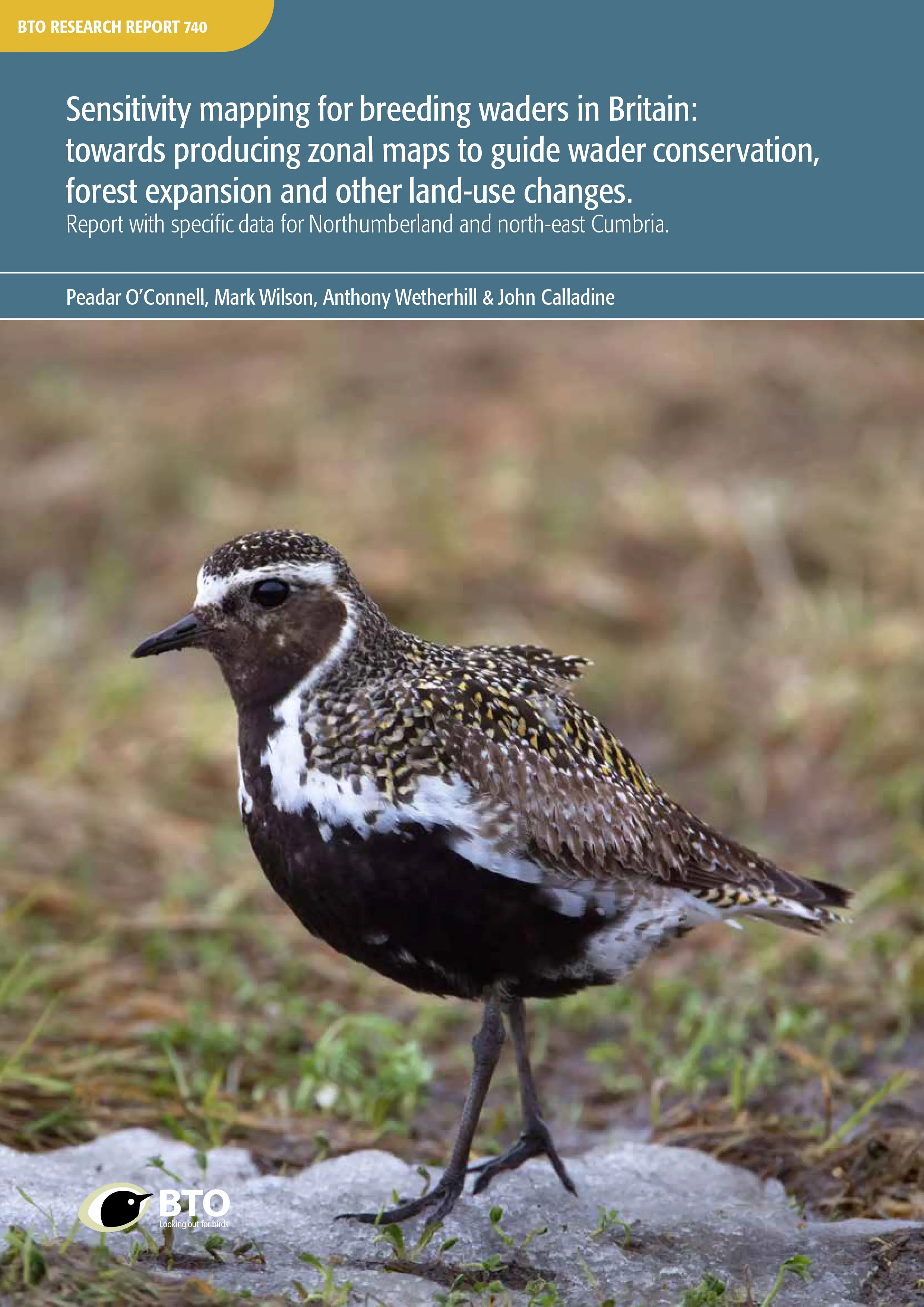
Sensitivity mapping for breeding waders in Britain: towards producing zonal maps to guide wader conservation, forest expansion and other land-use changes. Report with specific data for Northumberland and north-east Cumbria
Author: O’Connell, P., Wilson, M., Wetherhill, A. & Calladine, J.
Published: 2021
Breeding waders in Britain are high profile species of conservation concern because of their declining populations and the international significance of some of their populations. Forest expansion is one of the most important, ongoing and large-scale changes in land use that can provide conservation and wider environmental benefits, but also adversely affect populations of breeding waders. We describe models to be used towards the development of tools to guide, inform and minimise conflict between wader conservation and forest expansion.Extensive data on breeding wader occurrence is typically available at spatial scales that are too coarse to best inform waderconservation and forestry stakeholders. Using statistical models (random forest regression trees) we model the predicted relative abundances of 10 species of breeding wader across Britain at 1-km square resolution. Bird data are taken from Bird Atlas 2007–11, which was a joint project between BTO, BirdWatch Ireland and the Scottish Ornithologists’ Club, and modelled with a range of environmental data sets.
09.12.21
Reports Research reports
Consequences of population change for local abundance and site occupancy of wintering waterbirds
Author: Méndez, V., Gill, J.A., Alves, J.A., Burton, N.H.K. & Davies, R.G.
Published: 2017
Protected sites for birds are typically designated based on the site’s importance for the species that use it. For example, sites may be selected as Special Protection Areas (under the European Union Directive on the Conservation of Wild Birds) if they support more than 1% of a given national or international population of a species or an assemblage of over 20,000 waterbirds or seabirds. However, through the impacts of changing climates, habitat loss and invasive species, the way species use sites may change. As populations increase, abundance at existing sites may go up or new sites may be colonized. Similarly, as populations decrease, abundance at occupied sites may go down, or some sites may be abandoned. Determining how bird populations are spread across protected sites, and how changes in populations may affect this, is essential to making sure that they remain protected in the future.
20.09.17
Papers